Leros - the Island of Artemis - is an island of untouched natural beauty and great harmony.
Let us travel through this website to an island where one would think that time moves to an entirely different pace. Leros is far from being a crowded tourist destination. Thus, an unforgettable experience for all is guaranteed since life on Leros is an authentic adventure.
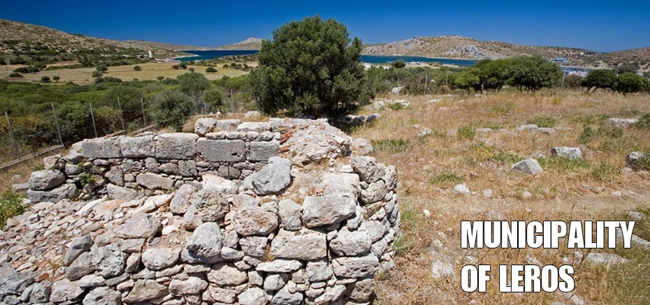
Leros is an island in the South Aegean and belongs to the Prefecture of the Dodecanese . It lies between Patmos and Leipsi to the north and Kalymnos to the south. It is 179 nautical miles from Greece ’s main port Pireaus and 7 nautical miles from the coast of Asia Minor ( Turkey ). Leros covers an area of 53 square kilometres with a long coastline of 71 metres filled with beautiful pristine beaches. Along the coastal areas many large natural gulfs and bays have evolved as a result of intense sea activity along its shores.
Thanks to sea’s intensity, Leros today is one of the last small, island paradises for all visitors searching for peace combined with a traditional way of life. It provides peace of mind and body surrounded by a wonderfully hospitable environment that will make you feel at home right from the first moment. This is the local inhabitants of the island emphatically declare. “Those who experience the island will never forget it.”
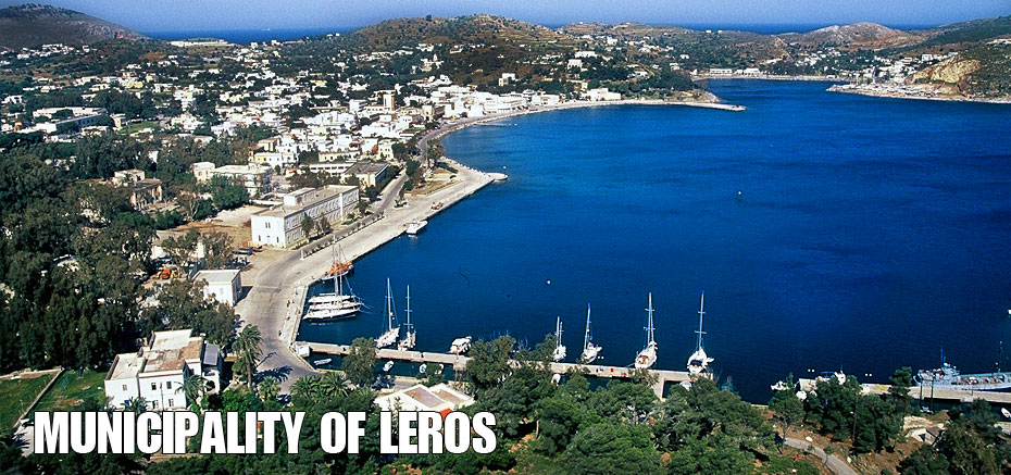
One of the most essential gulfs of Leros is Lakki, which is also one of the largest, naturally secure ports in the Mediterranean. During the Italian occupation of the Dodecanese, the Gulf of >Lakki was used as a naval base because of its natural element. The other important gulfs are at Partheni with three successive creeks and another one at Belfouti. Both of them are protected from the north winds by the smaller islands of Stroggili and Archangelos that function as natural barrier.
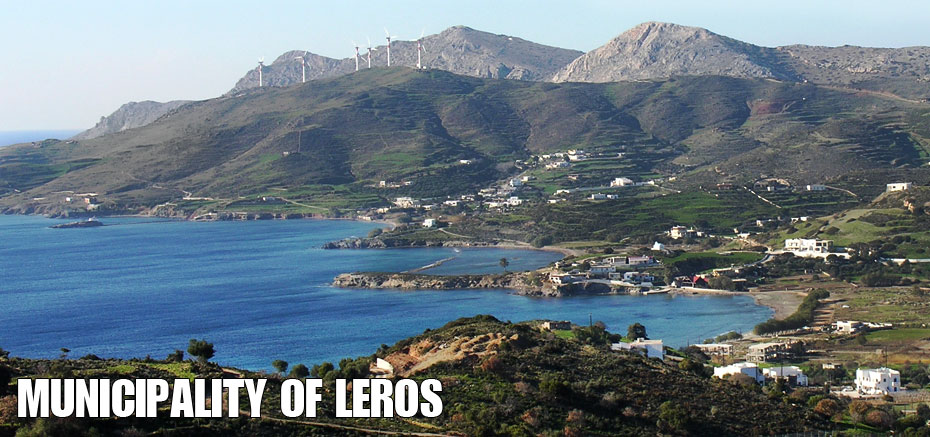
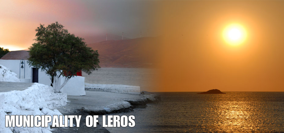
Additional, remarkable bays are Alinta, Xerokambos and Panteli. Also, there are beaches ideal for swimming, in smaller bays all along the coast.
Leros has a constantly changing landscape. It has an outline that demonstrates profound sea partitions and forms deep leeward shelters and large bays at many points. The greater part of the island is flat with valleys that reach as far as the sea and with low-lying mountains and its highest point being at Kleidi at 320 metres. This is why the island has derived its name from the ancient Greek word “leros” meaning smooth or level.
The landscape of Leros has a rather soft texture with Skoumbardos at 327 metres as the highest peak, in the south. From north to south, the hills of Kasteli, Turloti, Katevati, Klidi, Patelos, Turturas and Vathia Lagadia unfold lengthwise. Low, flat areas and fertile valleys are formed among those hills. Because of the mild climate, the cultivation of a variety of fruit including citrus fruit and olive trees is extremely favourable.
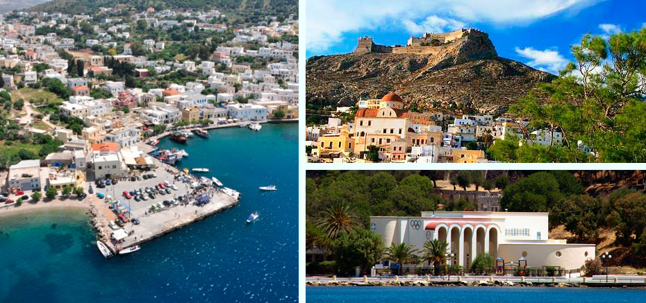
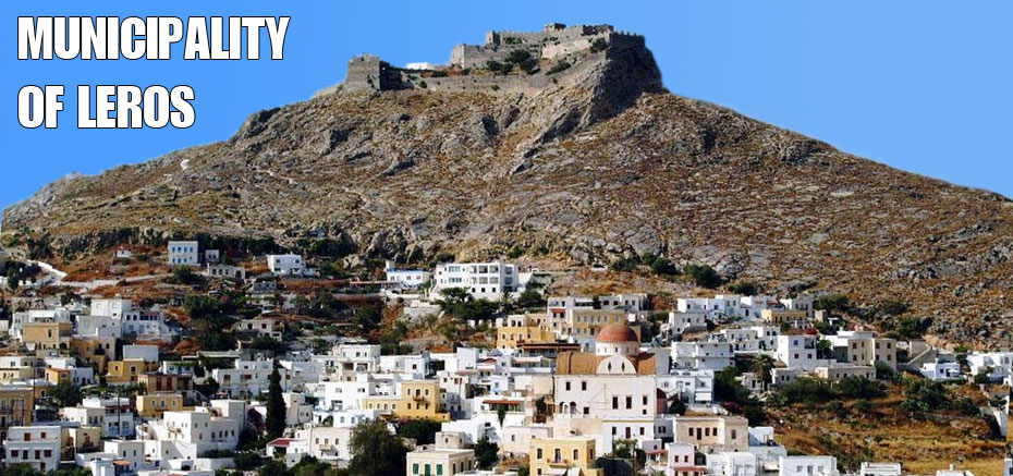
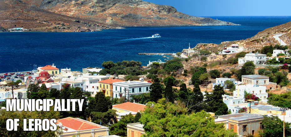
In the central part of the island, two powerful communities have been developed. All public services are concentrated within these polar communities. The populated area at Agia Marina and Lakki are linked along the axis of the main road with the rest of the island. Agia Marina is the capital of Leros’s Municipality and has a detailed, street infrastructure uniting the neighbourhoods of Agia Marina along the northern coast of the central region, Platanos between Castle Hill and the Merovigli high-grounds to Panteli creek and the bay by the same name. Panteli has a remarkable harbour which is alternatively used when weather conditions do not allow for ferries to moor into the main harbour at Lakki.
Along the coastal zone of Agia Marina, there are numerous places for entertainment and along the axis of the main road there is a less developed centre. Agia Marina has one of the island’s four Primary Schools, two Kindergartens, a Junior High School, the Cultural Municipal Centre, the Archaeological Museum which is housed in a well-preserved, neo-classical Nobleman’s home, the Financial Services or the Revenue Building, the Post Office, Greece’s Telecommunications Organization (OTE), banks and the local radio and Police stations. The Public Services of Leros’s Municipality are established in the neo-classic building at the square. Although the building is strategically located at the town square, the building itself is insufficient to meet the actual needs. The Municipal Library and the Leros’s Historical Archives are housed in neighbouring buildings. The OTE building lies on the road towards Agia Marina.
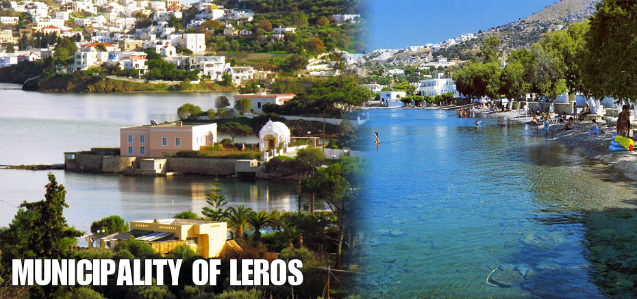
The local shops cover the annual as well as the seasonal demands for both produce and merchandise. There are no public service offices in Panteli. Nevertheless, many restaurants and entertainment venues have been established along the attractive beach area. At the two ends of the settlement and in a very special natural beauty setting, there are some scattered homes and other residential units, and country homes can be seen at Krithoni and Vromolithos. Still, both regions are not yet included within the borders of the official city plan, despite the fact that these two areas are in the vicinity of the island’s capital.
The second area is Lakki, where many developments that exceed the ‘local’ characterization are concentrated.
The port at Lakki is the Leros’s most vital one and facilitates the transportation of both passengers and goods to and from the island.
Leros’s State Rehabilitative Institution provides high calibre medical services to all of its inhabitants.
There is a wide range of established commercial enterprises as well as manufacturing businesses. These services concentrate the highest percentage of Leros’s workforce, daily.
At the centre of this Italian designed development, the following operations exist: -
Retail businesses, restaurants and recreational facilities, public and municipal services, the Port Police, Police, Leros’s Municipal Enterprise of Sewage and Waterworks, as well as educational institutions including two Kindergartens, a Primary and a Junior High School and a >Technical College.
In the soft, rolling hills to the north of Lakki, residential communities have been built at Agios Theologos and in the area of the Byzantine Church by the same name as well as at Kamaraki. These are the suburb regions of the Lakki area. Moreover, the settlement at Mili - Plaka is also developed but, it is a sparsely built area with a problematic formation and a lack of organization and infrastructure. These residential developments constitute the suburban territory of Lakki and depend on it for all their service needs and requirements.
The most distant areas from the island’s capital are Partheni to the north and Xirokambos to the south. These communities are at the limit of the island’s road network. The homes in these areas belong to fisherman and show limited tourist activity. To the west at the Bay of Gourna is the village of Drimonas which belongs to the urban area of Lakki and is accessible by the northern road network.

")


")